 wehub-resource-sync
7df9ebf22c
wehub-resource-sync
7df9ebf22c
Sync labels / sync (push) Failing after 1m9s
Publish Container Image / Build and publish container image (push) Has been cancelled
Deploy Website / Deploy to GitHub Pages (push) Has been cancelled
Deploy Website / Build website and demo (push) Has been cancelled
Deploy viewer / Deploy viewer proxy to Cloudflare Workers (push) Has been cancelled
Deploy tiles / Deploy planetary tile proxy to Cloudflare Workers (push) Has been cancelled
Deploy collab / Deploy collaboration relay to Cloudflare Workers (push) Has been cancelled
CI / Dependency audit (push) Has been cancelled
CI / E2E smoke (Playwright) (push) Has been cancelled
CI / Validate CITATION.cff (push) Has been cancelled
CI / Build and test (push) Has been cancelled
92 lines
5.8 KiB
Markdown
92 lines
5.8 KiB
Markdown
# Data Integrations
|
|
|
|
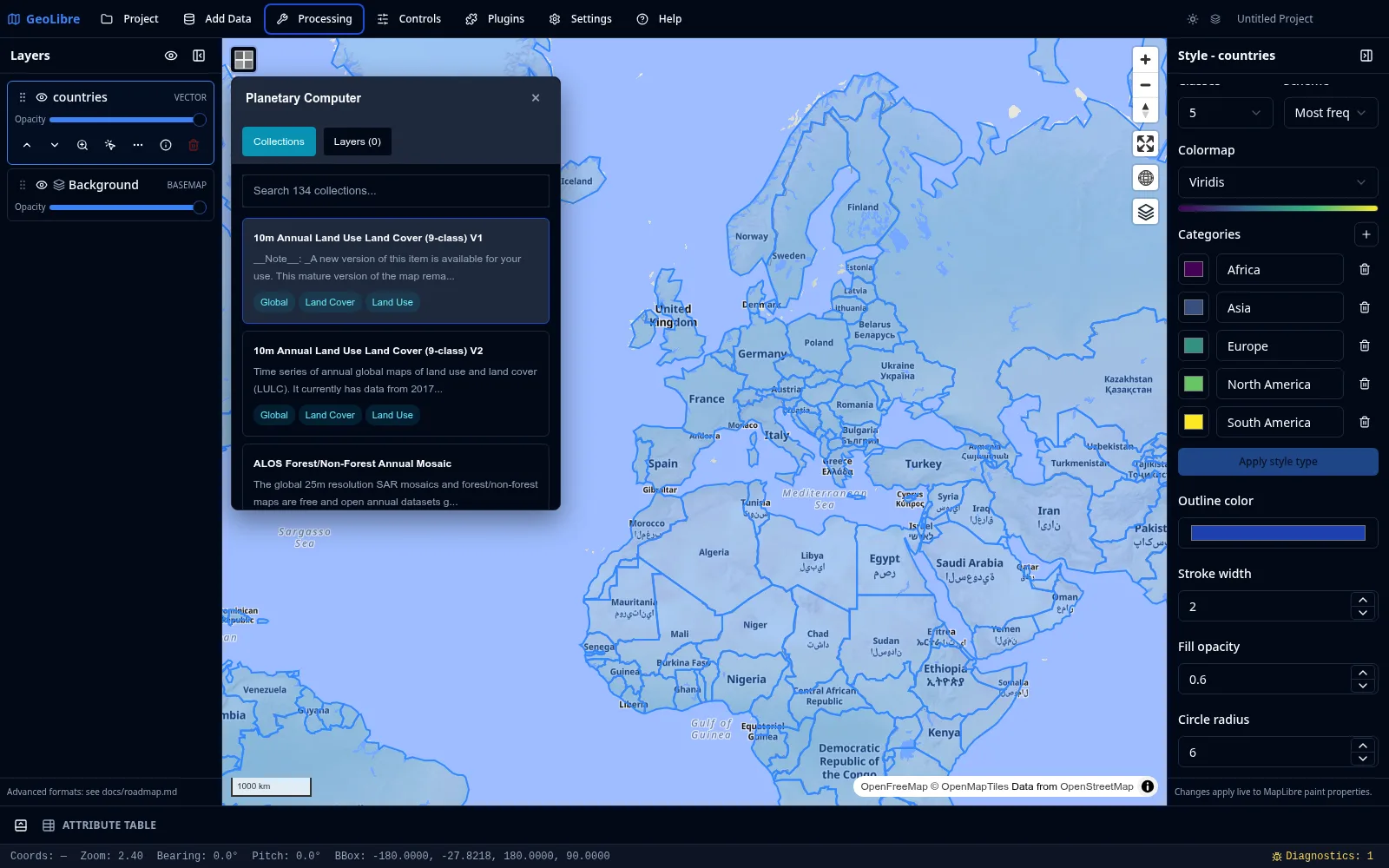
Beyond the [Add Data](adding-data.md) menu, GeoLibre connects to several hosted catalogs and imagery providers through dedicated panels and plugins. This page is a map of what is available and where to find it.
|
|
|
|
|
|
|
|
## Cloud catalogs
|
|
|
|
| Integration | Where | What it does |
|
|
| --- | --- | --- |
|
|
| **Planetary Computer** | Processing menu | Browse and load STAC data from Microsoft Planetary Computer (Sentinel, Landsat, and more). |
|
|
| **Earth Engine** | Processing menu | Browse and load Google Earth Engine datasets after authenticating. |
|
|
| **Overture Maps** | Plugins menu | Load Overture Maps data themes (such as buildings, places, and transportation). |
|
|
| **STAC** | Add Data menu | Search any STAC catalog and add matching raster items. See [Adding Data](adding-data.md#web-services). |
|
|
|
|
!!! note "Credentials"
|
|
Earth Engine requires authentication, and some providers expect an API key or token. Set these in **Settings → Environment Variables**. See [Settings & Preferences](settings.md).
|
|
|
|
## Federal Web Services
|
|
|
|
The **Web Services** submenu of the [Plugins menu](plugins.md) bundles four United States federal data sources:
|
|
|
|
| Service | Data |
|
|
| --- | --- |
|
|
| **FEMA** | National Flood Hazard Layer (NFHL) flood data. |
|
|
| **NASA Earthdata** | NASA satellite and Earth science imagery. |
|
|
| **EPA EnviroAtlas** | Environmental and ecosystem data. |
|
|
| **USGS** | The National Map topographic and geographic layers. |
|
|
|
|
## Imagery and street-level
|
|
|
|
| Integration | Where | What it does |
|
|
| --- | --- | --- |
|
|
| **Historical Imagery** | Plugins menu | Browse historical Esri World Imagery snapshots. |
|
|
| **Street View** | Plugins menu | View Google Street View and Mapillary street-level imagery. Needs provider credentials (see [Getting Started](../getting-started.md#optional-imagery-credentials)). |
|
|
|
|
## Time series and comparison
|
|
|
|
| Plugin | What it does |
|
|
| --- | --- |
|
|
| **Time Slider** | Animate time series raster and vector data (COG, XYZ/WMTS, WMS-Time, and time-filtered GeoJSON) through a docked timeline. |
|
|
| **Layer Swipe** | Compare two layers side by side with a swipe handle. |
|
|
|
|
## AI analysis
|
|
|
|
| Plugin | What it does |
|
|
| --- | --- |
|
|
| **GeoAgent** | AI-assisted geospatial analysis. |
|
|
|
|
All of these are activated from the [Plugins menu](plugins.md), where you can also set their on-map position.
|
|
|
|
## Geocoding
|
|
|
|
GeoLibre can turn addresses into points and points into addresses. Both run through a selectable provider; the public [Nominatim](https://nominatim.openstreetmap.org/) service is the default and needs no key.
|
|
|
|
| Tool | Where | What it does |
|
|
| --- | --- | --- |
|
|
| **Geocode Addresses** | Processing menu | Pick a CSV with an address column and geocode each row into a point layer. Each matched row keeps its original columns plus `geocode_lat`, `geocode_lon`, `geocode_display_name`, and `geocode_importance` (a match score). A per-run provider picker lets you switch backend for that batch. |
|
|
| **Reverse Geocode** | Controls menu | A toggle. While on, click anywhere on the map to look up the address at that point, shown in a popup with a copy button. |
|
|
|
|
Both send coordinates or addresses to a third-party service, so the first time you enable Reverse Geocode (and whenever you run a batch) your data leaves your device for those requests. Reverse Geocode shows a one-time notice before it is first enabled.
|
|
|
|
### Providers
|
|
|
|
Choose a backend in **Settings → Geocoding**. The selection, per-provider API keys, optional endpoint overrides, and contact email are saved with the project.
|
|
|
|
| Provider | API key | Notes |
|
|
| --- | --- | --- |
|
|
| **Nominatim (OpenStreetMap)** | No | Default. Public endpoint is paced and row-capped (see below); point it at a self-hosted instance to relax both. |
|
|
| **Pelias** | Optional | Hosted [geocode.earth](https://geocode.earth/) needs a key; a self-hosted Pelias does not. |
|
|
| **ArcGIS World Geocoder** | Yes | Esri token / API key. |
|
|
| **Mapbox** | Yes | Mapbox access token (`pk.…`). |
|
|
| **Google** | Yes | Google Maps Geocoding API key. Google does not officially allow browser cross-origin requests to this API, so a same-origin proxy may be required. |
|
|
|
|
API keys are stored in plain text in the `.geolibre.json` project file, so avoid sharing a project that carries them (the Project → Share flow can strip environment variables, but provider keys live under Geocoding settings).
|
|
|
|
### Usage policy and limits
|
|
|
|
Requests to the public Nominatim endpoint are paced to one per second and a single batch run is capped at 1000 rows, in line with the [Nominatim usage policy](https://operations.osmfoundation.org/policies/nominatim/). Browsers cannot set a `User-Agent`, so the app identifies itself through the page `Referer` and the optional `email` parameter. Self-hosted Nominatim and the keyed providers (Mapbox, ArcGIS, Google, hosted Pelias) are not paced or capped by GeoLibre; their own quotas apply.
|
|
|
|
### Configuring with environment variables
|
|
|
|
The Geocoding settings panel is the easiest way to configure a provider, but the same values can also be set as runtime environment variables (the same `VITE_`-prefixed mechanism used for [imagery credentials](../getting-started.md#optional-imagery-credentials)). Explicit environment variables override the Settings panel.
|
|
|
|
| Variable | Default | Purpose |
|
|
| --- | --- | --- |
|
|
| `VITE_GEOCODER_PROVIDER` | `nominatim` | Provider id: `nominatim`, `pelias`, `arcgis`, `mapbox`, or `google`. |
|
|
| `VITE_GEOCODER_API_KEY` | unset | API key / access token for the selected provider. |
|
|
| `VITE_GEOCODER_ENDPOINT` | provider default | Forward (address to point) search endpoint override. |
|
|
| `VITE_GEOCODER_REVERSE_ENDPOINT` | provider default | Reverse (point to address) endpoint override. |
|
|
| `VITE_GEOCODER_EMAIL` | unset | Contact email sent as the `email` query parameter to identify your client to Nominatim. |
|