 wehub-resource-sync
7df9ebf22c
wehub-resource-sync
7df9ebf22c
Sync labels / sync (push) Failing after 1m9s
Publish Container Image / Build and publish container image (push) Has been cancelled
Deploy Website / Deploy to GitHub Pages (push) Has been cancelled
Deploy Website / Build website and demo (push) Has been cancelled
Deploy viewer / Deploy viewer proxy to Cloudflare Workers (push) Has been cancelled
Deploy tiles / Deploy planetary tile proxy to Cloudflare Workers (push) Has been cancelled
Deploy collab / Deploy collaboration relay to Cloudflare Workers (push) Has been cancelled
CI / Dependency audit (push) Has been cancelled
CI / E2E smoke (Playwright) (push) Has been cancelled
CI / Validate CITATION.cff (push) Has been cancelled
CI / Build and test (push) Has been cancelled
32 lines
1.9 KiB
Markdown
32 lines
1.9 KiB
Markdown
# Attribute Table
|
|
|
|
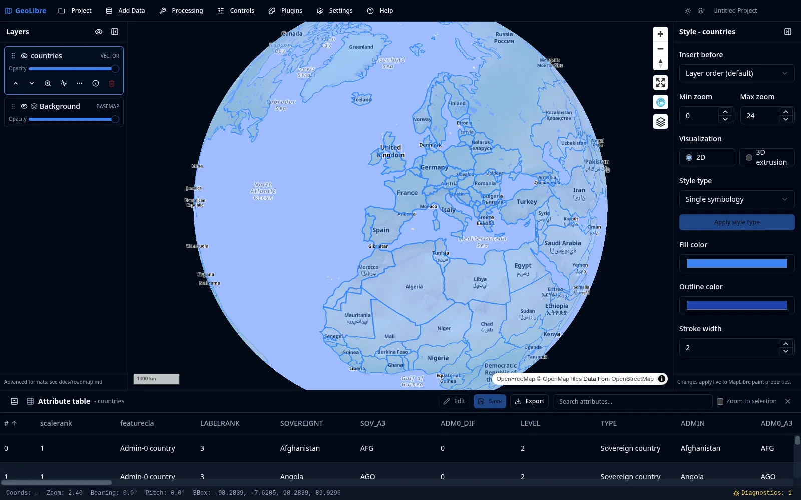
The **Attribute table** shows the records of the selected vector or DuckDB layer. Expand it from the **Attribute table** button on the status bar at the bottom of the window, then select a layer in the [Layers panel](layers.md) to populate it.
|
|
|
|
|
|
|
|
## Reading and navigating
|
|
|
|
- **Sort** by clicking a column header to order rows ascending or descending.
|
|
- **Resize** columns by dragging their borders, and scroll horizontally when a layer has many fields.
|
|
- **Filter** rows by attribute value to narrow large tables.
|
|
|
|
## Linking to the map
|
|
|
|
The attribute table and the map stay in sync:
|
|
|
|
- Selecting a row highlights the corresponding feature on the map.
|
|
- You can zoom the map to the selected feature.
|
|
- Selections support multiple features at once.
|
|
|
|
## Editing values
|
|
|
|
For editable layers (including GeoJSON layers and materialized DuckDB layers), you can edit attribute values inline. Combine this with the **GeoEditor** plugin to edit both geometry and attributes. See [Managing Layers](layers.md).
|
|
|
|
## DuckDB layers
|
|
|
|
Layers produced by the [SQL Workspace](sql-workspace.md) or added from a [DuckDB source](adding-data.md#databases) behave like vector layers here, with full identify, selection, and attribute table support. You can keep several DuckDB query-result layers open at once.
|
|
|
|
## Exporting
|
|
|
|
You can export the records you are viewing as GeoJSON, GeoParquet, GeoPackage, a zipped Shapefile, or CSV (attributes only). The same formats are available from a layer's context menu in the [Layers panel](layers.md). Exporting to Shapefile surfaces a warning when field names exceed the format's 10-character limit. The [SQL Workspace](sql-workspace.md) additionally exports query results as CSV or GeoParquet, and the [Conversion tools](processing.md#conversion) write cloud-native formats.
|