 wehub-resource-sync
7df9ebf22c
wehub-resource-sync
7df9ebf22c
Sync labels / sync (push) Failing after 1m9s
Publish Container Image / Build and publish container image (push) Has been cancelled
Deploy Website / Deploy to GitHub Pages (push) Has been cancelled
Deploy Website / Build website and demo (push) Has been cancelled
Deploy viewer / Deploy viewer proxy to Cloudflare Workers (push) Has been cancelled
Deploy tiles / Deploy planetary tile proxy to Cloudflare Workers (push) Has been cancelled
Deploy collab / Deploy collaboration relay to Cloudflare Workers (push) Has been cancelled
CI / Dependency audit (push) Has been cancelled
CI / E2E smoke (Playwright) (push) Has been cancelled
CI / Validate CITATION.cff (push) Has been cancelled
CI / Build and test (push) Has been cancelled
2.4 KiB
2.4 KiB
Map Controls & Tools
The Controls menu toggles two kinds of on-map helpers: the built-in MapLibre map controls, and the component panels that add tools like Measure and Bookmark. A check mark next to an item means it is currently shown.
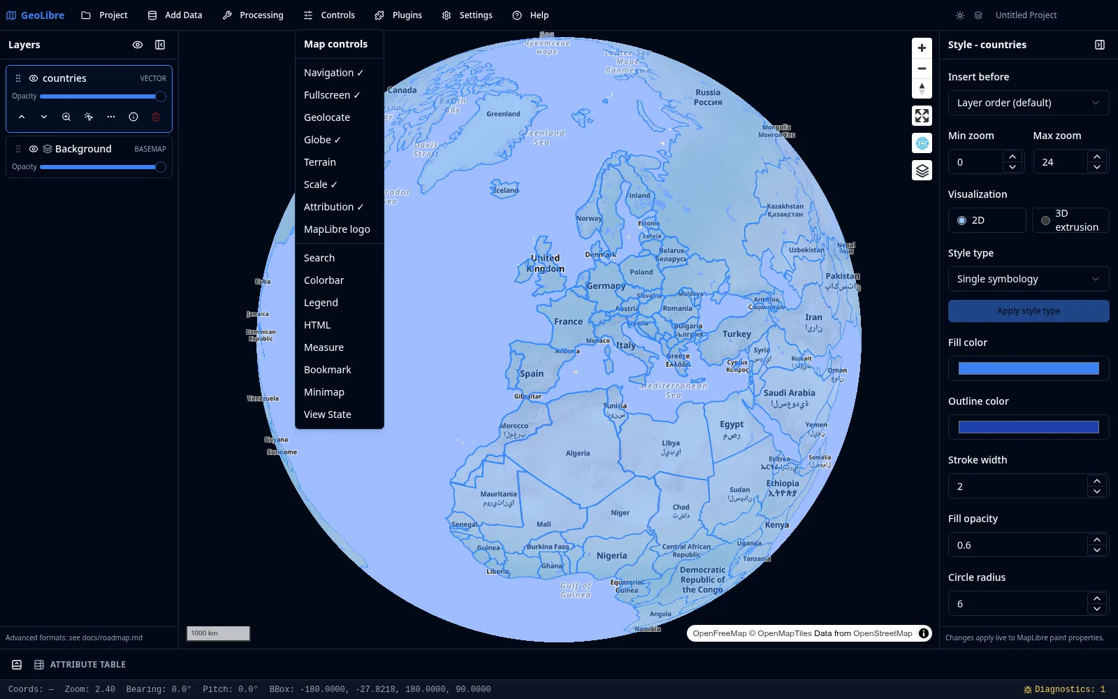
Map controls
These are the standard MapLibre controls that sit in the map corners:
| Control | Description |
|---|---|
| Navigation | Zoom in/out and a compass to reset bearing. |
| Fullscreen | Expand the map to fill the screen. |
| Geolocate | Center the map on your current location. |
| Globe | Switch between the flat map and a 3D globe projection. |
| Terrain | Toggle terrain (3D elevation) rendering. |
| Scale | Show a scale bar. |
| Attribution | Show data attributions. |
| MapLibre logo | Show or hide the MapLibre logo. |
Component tools
These are interactive panels provided by the MapLibre components plugin:
| Tool | Description |
|---|---|
| Search | Search for places by name and fly to the result. |
| Colorbar | Display a continuous color scale for raster values. |
| Legend | Show a legend describing the layers on the map. |
| HTML | Display custom HTML content in an on-map panel. |
| Measure | Measure distances and areas interactively. |
| Bookmark | Save named map views and jump back to them. |
| Minimap | Show an overview map of the current extent. |
| View State | Read and edit the exact center, zoom, bearing, and pitch. |
The Print tool lives under the Project menu.
!!! note "Control position" Plugin-backed controls can be positioned in any map corner. For plugins that support it, set the corner from the Plugins menu (top left, top right, bottom left, or bottom right).
Map navigation basics
- Pan: drag the map, or use the arrow keys while the map has focus.
- Zoom: scroll wheel, pinch, the navigation control, or the
+/-keys. - Rotate: hold the right mouse button and drag, use the compass, or
Shift+←/→. - Tilt: hold
Ctrl/Cmdand drag to tilt the map into a perspective view, orShift+↑/↓. - Reset the view: press
Nfor north up,Ufor a top-down view, orRto reset both pitch and bearing. See the interface guide for the full shortcut list.